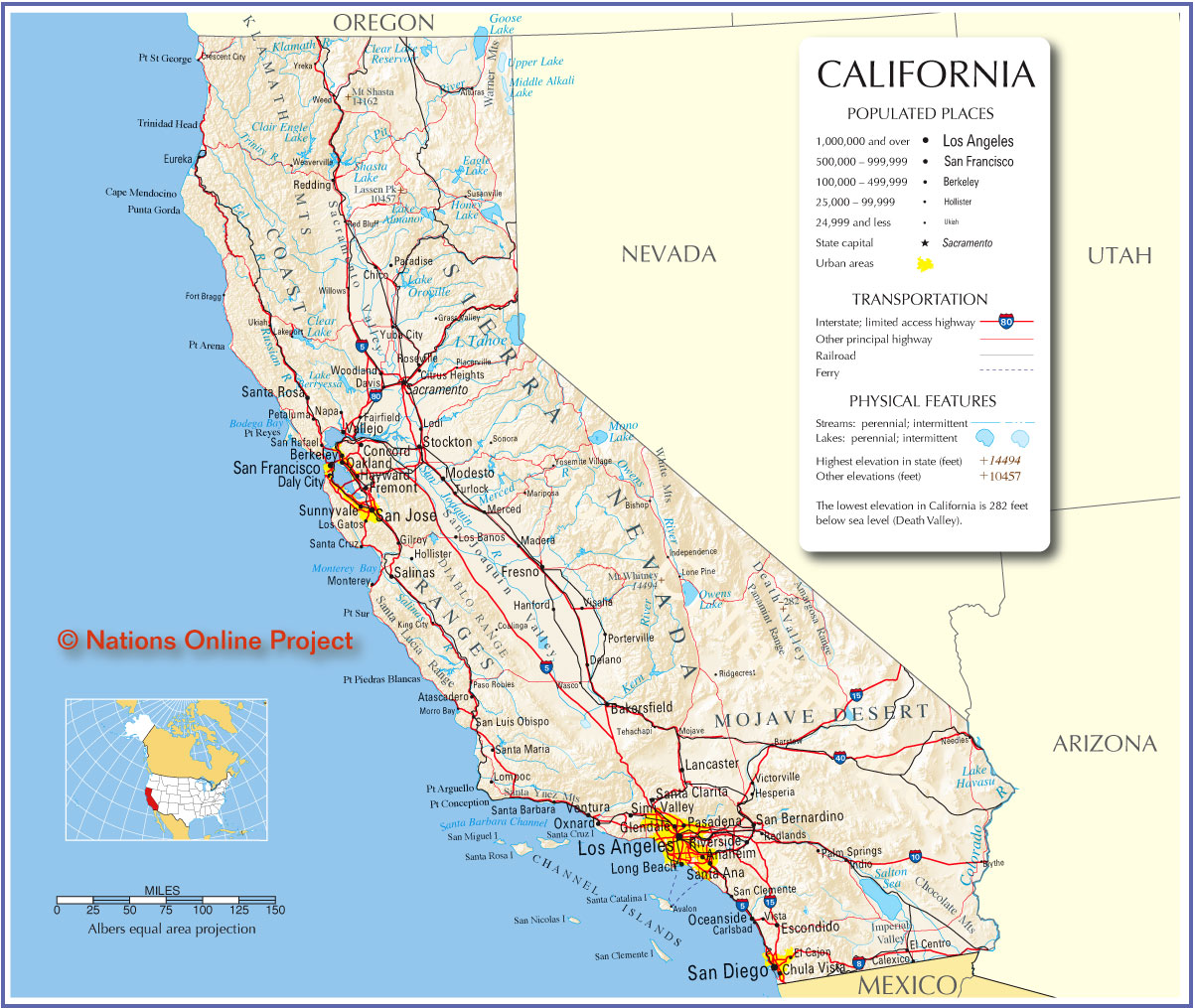
 This map is from the website: http://jdrhs69.org/map_files/map_images/California_map.jpg. The website is:

THE OFFICIAL WEBSITE OF THE JONATHAN DAYTON REGIONAL HIGH SCHOOL CLASS OF 1969
This is a map of the state of California. It shows all of the major cities and the freeways that connect them. The map also includes the most prominent features in California such as mountains, lakes, rivers, bays, and valleys.
I find this map interesting because I am very connected with California, it's cities, and of course it's freeways. I travel on California's freeways every week and it is interesting to see how they connect all of the major cities together. I like seeing all the places I have been and the places I want to go. It is interesting to compare my mental map of California with the actual map.

This map is from a BBC news article about the 2010 World Cup from the website: http://news.bbc.co.uk/1/hi/8140433.stm.
The map shows the locations for all of the stadiums that will be used in the World Cup this year in South Africa.
The map is interesting because it is very simple. It shows no roads or major landmarks other than a lake that isn't labeled. The map does give a general idea of where the soccer stadiums are, how far apart they are, and whether they are preexisting or built specifically for the World Cup. I like the map because it gives me a general idea of where the stadiums are and it is easy to read. As a map that is intended for fans not familiar with South Africa, I think it's simplicity is good because the map is just meant to give fans an idea of where the stadiums are located throughout South Africa.
 This map is from a website titled "WannaSurf". It is a website that shows where surf spots are and includes some information about them such as wave type and crowd type. The website is: http://www.wannasurf.com/spot/North_America/USA/California/San_Diego_County/.
The map shows all of the major surf spots in San Diego county.
The map is interesting because it really highlights the number of places there are to surf in San Diego. It is a unique map catered solely to surfers. The map is also interactive on the website so you can zoom in or out. The fact that the map is interactive is one of its most interesting features. Maps that can zoom in and out help me to get an idea of where the general location of a beach is as well as the specific location of the surf spot at that beach. The interactive map also has roads and freeways which gives good reference points.

No comments:
Post a Comment